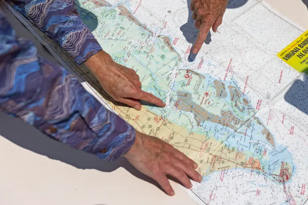
NORTHAMPTON COUNTY — Miles of clear, blue-green water span Virginia’s coastal peninsula, broken up by barrier islands and thriving salt marshes. The pristine environment offers a critical habitat for countless marine and bird species, and the largest seagrass restoration in the world.
With roughly 133,000 acres of conserved land off the Eastern Shore, the Nature Conservancy’s Volgenau Virginia Coast Reserve owns or manages about 40,000 acres and 14 barrier islands.
But these preserved waters could be in for a drastic disruption. Federal officials are considering the area as the trial location to lease land for seabed mining in the Atlantic Ocean. Environmental experts, including from the reserve, are sounding the alarm out of concern for water quality and ecosystems they believe would be under threat from such development.
The Bureau of Ocean Energy Management put forth a request for information and interest, or an RFI, on June 23 regarding proposals for seabed mining along the majority of the Eastern Shore coastline. The activity extracts critical mineral resources from the ocean floor. The proposed mining area runs between 3 and 63 miles offshore.
A public comment period for the proposal is open through Aug. 22. The Virginia Coast Reserve said they welcome the opportunity to personally show BOEM officials the novel ecosystems that could be under threat after 60 years of conservation.
“There’s so many unknowns,” said program director Jill Bieri. “The thought that we would explore so close to this system and not really know what the impacts would be long term is scary for us. This is just not the place to do this kind of exploration or eventual mining.”
A unique habitat
The Eastern Shore is home to sprawling farms, thousands of acres of protected land and the barrier islands. A designated UNESCO site, the Virginia Coast Reserve is one of the last coastal wildernesses on the East Coast.
Twenty-three barrier and marsh islands, from Fishermans Island to Assateague, protect the mainland and coastal bays from coastal storms and ocean waves. The islands were once inhabited by families and watermen until the 1940s after erosion and sea level rise made it unsustainable.
“They were seeing change to the barrier islands, not just generation to generation, but storm to storm,” said Barrier Islands Center Director Sally Dickinson.
The Nature Conservancy’s reserve program has managed 14 of the barrier islands for almost 60 years, after conserving the islands from development in the 1970s.
Sitting on the bow of a boat as it pulled away from the Eastern Shore, reserve coastal migratory birds scientist Alex Wilke was quick to point out a feeding oystercatcher. The coastal bays gather the highest number of breeding oystercatchers in the Atlantic Coast range, Wilke said. But the significance of these habitats bleed into migration and non-breeding seasons as well. Species such as piping plovers, terns, and waders use these islands to lay their eggs and raise their young. Others, Wilke said, use the islands as “jumping off points” for migrations, as they flock toward South America.
The fishing industry and aquaculture are propellers for the local economy. Clam and oyster beds are abundant in the coastal bays. Oyster reefs and seagrass meadows act as “fish factories” for species like red drum, speckled trout and seahorses, explained coastal marine habitats scientist for the Virginia Coast Reserve Bo Lusk. Even the insides of oyster shells serve as homes for an abundance of species, like mud crabs and small fish.
Guides take visitors out to recreationally fish, and commercial watermen depend on the coastal bay and the waters just offshore the islands for business, Lusk said. The RFI area also overlaps with the Mid-Atlantic Bight, the coastal habitat that serves as a migratory path for dolphins, and fin, humpback and North Atlantic right whales.
Around 12,000 acres of eelgrass off the Eastern Shore make up the largest seagrass restoration project in the world. Standing waist-deep in the water, Lusk compared the seagrass meadows to a “giant Tums” for the bay, buffering against increasing ocean acidity. This allows for stronger shells on clams, oysters and scallops. Seagrass meadows also have the potential to store more carbon per acre than a forest, Lusk said.
Public interest in the proposal
Since the public comment period on the seabed mining RFI opened, more than 1,000 Eastern Shore residents, local officials, politicians, environmental groups, and companies have weighed in on the proposal.
The purpose of the RFI is to gauge industry and public interest to guide future decisions about the potential leasing areas, according to BOEM. It is not a final decision to lease the minerals, and the designated area might not be the ultimate location.
The proposed mining area is over 2,000 square miles and ranges in water depth from 30 to 410 feet. It begins southeast of the Eastern Shore in the North Atlantic and ends before the Maryland border.
The Accomack County Board of Supervisors, as well as Northampton County, responded with direct opposition, citing “unacceptable risks” to coastal communities, economy, environment and national defense assets, including the Mid-Atlantic Regional Spaceport and NASA’s Wallops Flight Facility.
A Mississippi-based satellite launch company, The Spaceport Company, commented in support of leasing offshore areas for industrial activity. CEO Tom Marotta said he has no opinion on offshore mining, but is interested to see what the RFI means for other fields.
“Let’s open up that conversation because prior to this, there was no opportunity to even consider new ideas in the Atlantic,” Marotta said.
The move comes after President Donald Trump signed an executive order in April 2025 that outlines steps government agencies should take to “advance United States leadership” in seabed mineral resources. In November, Odyssey Marine Exploration submitted an unsolicited request to BOEM to lease hard minerals in the proposed area. That was the catalyst for the RFI, the first step in analyzing the proposal.
In a statement, an Odyssey spokesperson said the company’s current objective is to conduct scientific exploration that would help determine the “quantity and quality of the resource.”
The RFI does not specify which exact minerals would be mined, but mentions minerals of primary interest, including heavy mineral sands and phosphorites. Odyssey’s request echoes this, referring to the area as “highly prospective for heavy mineral sands” rich in titanium, zirconium, rare earth elements, and phosphate. These minerals are key ingredients for whitening agents that can be used to make paint, as well as glass, magnets and batteries.
The heavy mineral sands would likely be collected using “hopper dredge equipment,” or trailing suction hopper dredgers, then taken to a land-based facility for separation and processing, according to BOEM.
Environmental groups, including the Southern Environmental Law Center and Lynnhaven River NOW, oppose opening the area up to seabed mining. Their concerns range from weakened water conditions to complete destruction of habitats.
Deep-sea ecologist Andrew Thaler conducted research specific to the proposal, and guided Lynnhaven River Now’s understanding of the project’s scope. Thaler’s report from this year shows this type of dredging drags heavy suction pipes along the seafloor to extract loose materials, breaking up the first few feet of seabed while water jets liquidize the sand to be pumped.
Public comments can be submitted through Aug. 22 at www.regulations.gov by searching for docket number BOEM-2026-0100. Once the comment period closes, BOEM will analyze feedback and conduct an environmental impact assessment, said Lynnhaven River NOW public policy manager Dylan Mason. It could be over a year before a potential lease sale, he said.
Potential mining effects
Virginia Beach-based Lynnhaven River Now believes potential risks could extend farther than the Eastern Shore — as far as Maryland, Delaware and North Carolina, according to Mason.
“This project is right north of the mouth of the Chesapeake Bay,” Mason said. “The way that we have looked at it could have impacts to water quality and migratory species, whether that’s fish, marine mammals, or birds and waterfowl.”
Offshore heavy mineral sands and phosphorites extraction raises a common dredging concern for environmentalists: sediment plumes.
According to Thaler’s research, dredging disperses suspended sediment for “tens to hundreds of miles” depending on currents. This can clog or erode fish gills, bury or smother fish eggs, disrupt migration routes and adversely impact seagrass. The plumes can also contain heavy metals, risking the health of marine life and seafood consumers.
“Through the operations of dredging for navigational purposes and beach renourishment, we do know that there are negative effects,” Mason said. “But there’s a cost benefit analysis there, and it’s done on a much smaller scale.”
In terms of direct impacts, Thayer’s analysis asserts that dredging destroys any deep-sea ecosystem it comes in contact with.
In a statement to The Virginian Pilot, an Odyssey spokesperson said the company understands why Eastern Shore residents have questions, and respects their concerns.
“The Eastern Shore is valued for its fisheries, coastal environment, tourism, maritime heritage, and quality of life,” the company’s statement said. “The purpose of the current BOEM process is to collect information, identify questions, evaluate environmental conditions, and gather stakeholder input before any development decisions are made.”
Lusk, who grew up near Cape Charles, said he didn’t realize how special the Eastern Shore was until college when he saw it through the eyes of visitors or school friends he brought home to visit the area.
“I know that there’s nothing else like this in the world, and to put a system like this at risk just makes no sense to me at all,” Lusk said. “I think it would be major loss to our little community.”
Maggie Allwein, 757-672-3310, maggie.allwein@virginiamedia.com